


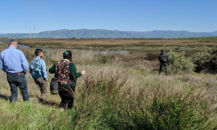
Wine Country County Counts for Half of California’s Repeat Home Flooding

Photo: Beth Schlanker, Press Democrat
On February 15, 1986, somewhere along the Russian River amid the quiet woodlands of unincorporated Sonoma County, a home flooded.
The same home flooded again in 1995. Then again in 1997. And again and again.
By 2019, the same property had flooded eight times since the 80s, and received more than $750,000 in disaster money from the National Flood Insurance Program. In nearby neighborhoods, dozens of other properties were flooding every five years or more on average, and one unit flooded 20 times — almost every other year. They are among more than 40,000 parcels nationwide that have suffered multiple catastrophic floods since 1978, according to an interactive map recently updated and re-released by the Natural Resources Defense Council called Losing Ground: Severe Repetitive Flooding in the United States.
Losing Ground reveals that Sonoma has more of these “Severe Repetitive Loss Properties” than any other county in the Western U.S. Unearthing that tidbit from the cavernous databases of the Federal Emergency Management Agency would prove near-impossible for even the savviest fact-finder, but I was able to reach the same conclusion in under a minute thanks to the map’s intuitive interface.
To create the free tool, the NRDC mapped the number of Severe Repetitive Loss Properties from FEMA’s data in every county in the U.S., for every year from the late 1970s to 2022. Perhaps more importantly for preventing future flooding, the map also shows how many properties underwent efforts to reduce flood risk, also called “mitigation,” and what proportion had insurance in any given year at the county, state, or national level.

The tool houses lots of details without sacrificing simplicity in viewing and comparing the data — a feat I found far more impressive after poking through some of the source information. My Internet browser balked at loading subsets of the nearly 45,000 rows of data, and unknown acronyms occasionally led to dry FEMA documents. But viewing the source data alongside the Losing Ground map led to some surprising insights that would be hard to glean from either one on its own — like how a quarter of all California’s Severe Repetitive Loss Properties come from a single zip code in Sonoma County that’s home to the unincorporated community of Guerneville and fewer than 5,000 people.
Ultimately, the data may only be as useful as regulators make it. Exhausted property owners and tenants in the riskiest areas are often perversely incentivized to rebuild in place. Even people with flood insurance often lack the resources to rebuild more flood-resilient structures. And in California, only one of the 300-500 repeat-offender properties has achieved a lower flood risk in any way since 2005, from setting back the property to a government buyout to engineering projects designed to improve flooding.
During the same time, Losing Ground shows a 36% increase in the number of Severe Repetitive Loss Properties in California, with more than 200 new parcels joining the ranks of the perpetually at-risk. This year-by-year breakdown reflects a sobering nationwide trend in flooding: policy and funding for solutions are far outpaced by the growth of places at risk.
Top Photo: A little pink house, the kind often on the frontlines of a lost American dream according to 1980s songwriter John Mellencamp, gets flooded during the atmospheric river rains of February 2024 in Guerneville. Photo: Beth Schlanker, Press Democrat
Other Recent Posts
Slow Progress on Shade For California’s Hottest Desert Towns
Coachella Valley communities face record temperatures with little shade. Policy changes lag as local groups push for heat equity.
In Uncertain Times, the Port of Oakland Goes Electric
A $322M grant powers Oakland’s port electrification — cleaning air, cutting emissions, and investing in community justice.
Testing Adaptation Limits: Mariposa Trails, Marin Roads & San Francisco Greenspace
In KneeDeep’s new column, The Practice, we daylight how designers, engineers and planners are helping communities adapt to a changing climate.
ReaderBoard
Once a month we share reader announcements: jobs, events, reports, and more.
Boxes of Mud Could Tell a Hopeful Sediment Story
Scientists are testing whether dredged sediment placed in nearby shallows can help our wetlands keep pace with rising seas. Tiny tracers may reveal the answer.
“I Invite Everyone To Be a Scientist”
Plant tissue culture can help endangered species adapt to climate change. Amateur plant biologist Jasmine Neal’s community lab could make this tech more accessible.
How To Explain Extreme Weather Without the Fear Factor
Fear-based messaging about extreme weather can backfire. Here are some simple metaphors to explain climate change.
Live Near a Tiny Library? Join Our Citizen Marketing Campaign
KneeDeep asks readers to place paper zines in tiny street libraries to help us reach new folks.
Join KneeDeep Times for Lightning Talks with 8 Local Reporters at SF Climate Week
Lightning Talks with 8 Reporters for SF Climate Week
Staying Wise About Fire – 5 Years Post-CZU
As insurance companies pull out and wildfire seasons intensify, Santa Cruz County residents navigate the complexities of staying fire-ready.
More
- FEMA Updates Flood Maps in Sonoma County, Santa Rosa and Windsor (July 2023)
- Atmospheric rivers drive flood damages in the western United States | Science Advances
- More U.S. homes are repeatedly flooding as the nation’s flood risk grows – The Washington Post
- Why California’s Water Extremes are Wilder than Ever April 2023, KneeDeep Times
- Two Towns Shortlisted for FEMA Millions, November 2022, KneeDeep Times


