Wildfire in the Big City?
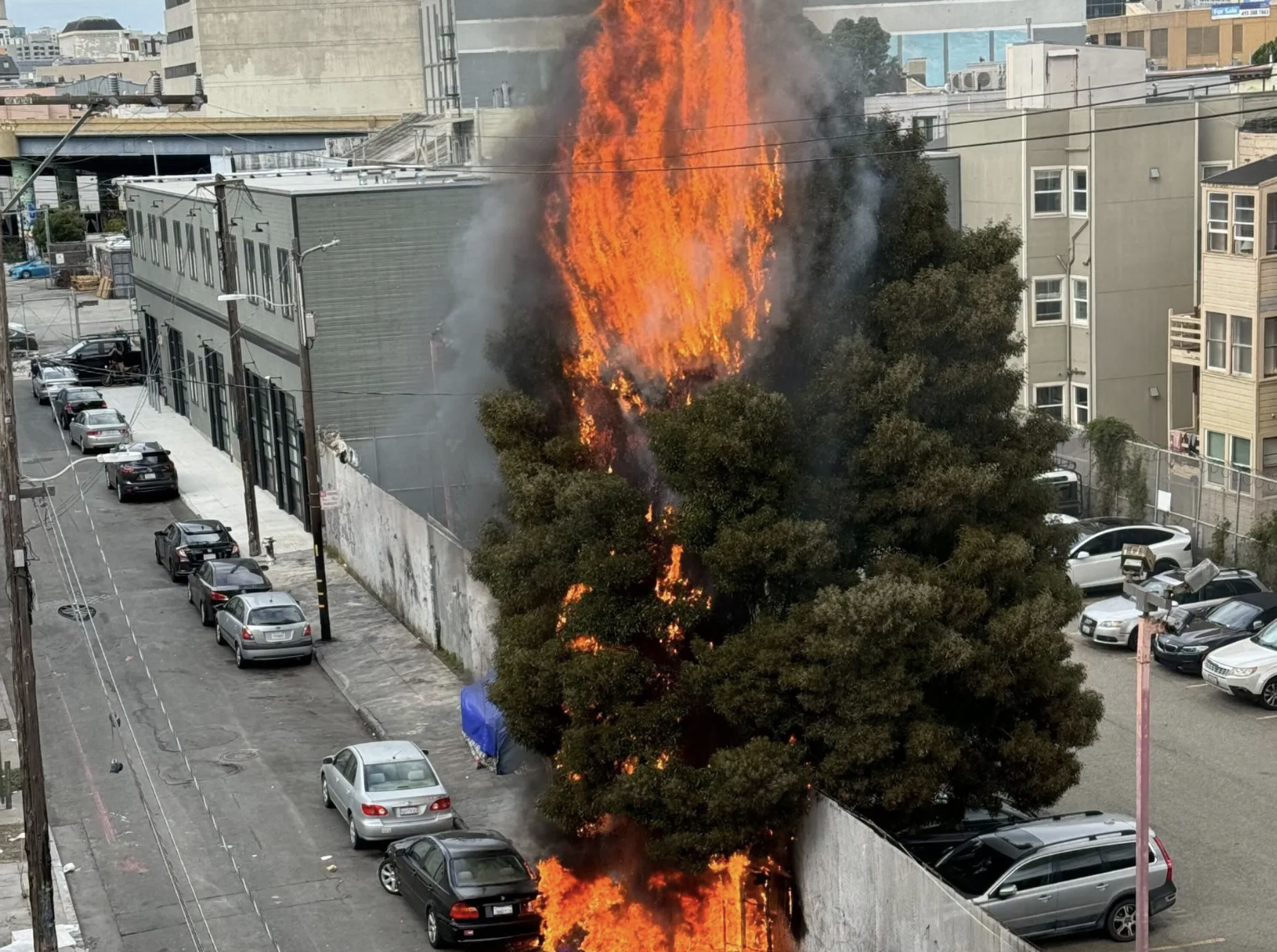
Disaster movies have staged San Francisco as the site of many a catastrophe — earthquakes, tsunamis, an intelligent ape uprising. But wildfire? It’s hard to picture.
Even as red flag warnings go into effect throughout the Bay Area, wildfires feel like a problem for rural neighborhoods, or East Bay communities deep in the hills — not the shiny, urbanized landscape of San Francisco.
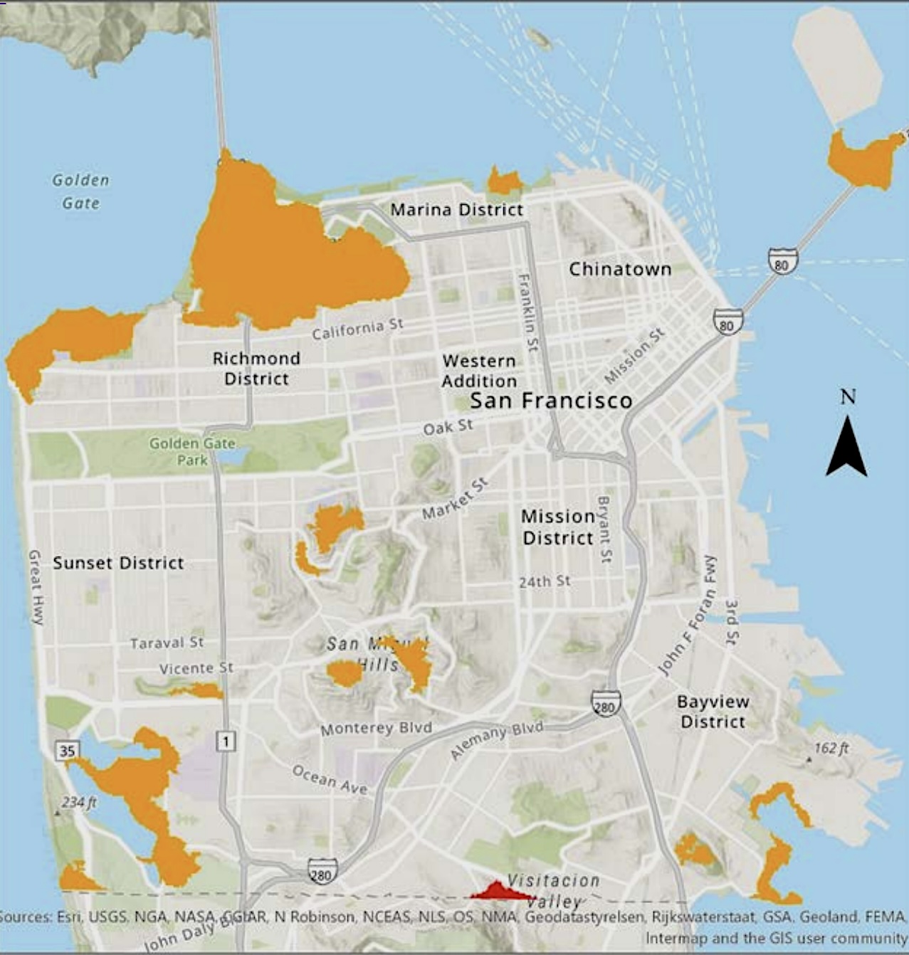
But according to San Francisco’s 2025 Draft Hazards and Climate Resilience plan, there are pockets of wooded areas in the city that could pose a wildfire risk, by their definition of wildfire: “an unplanned, uncontrolled fire in an area of combustive vegetation or fuel.” A small portion of the Crocker Amazon neighborhood has been designated as a high wildfire hazard area, and several other parcels, including wooded areas around Mounts Sutro and Davidson, Glen Canyon Park, and the Presidio, have a moderate wildfire risk. In these tiny forests, fires that start in the trees can easily become “wildland-urban interface wildfires” that spread into neighborhoods.
Right now, the risk is “low to moderate” — CALFire has no record of any wildfires in San Francisco since they started keeping records in 1943. However, San Francisco resident Denise Louie is worried that the city isn’t taking enough precautions. On walks along the O’Shaughnessy Boulevard border of Glen Canyon Park, she says, she’s seeing leafless, dead trees and branches, eucalyptus with peeling bark, and thick layers of vegetative litter – all fire hazards.
“[The problem is] the poor condition of those tree stands,” she says. “They have been through a couple of periods of prolonged drought, and that makes them more worrisome than before.”
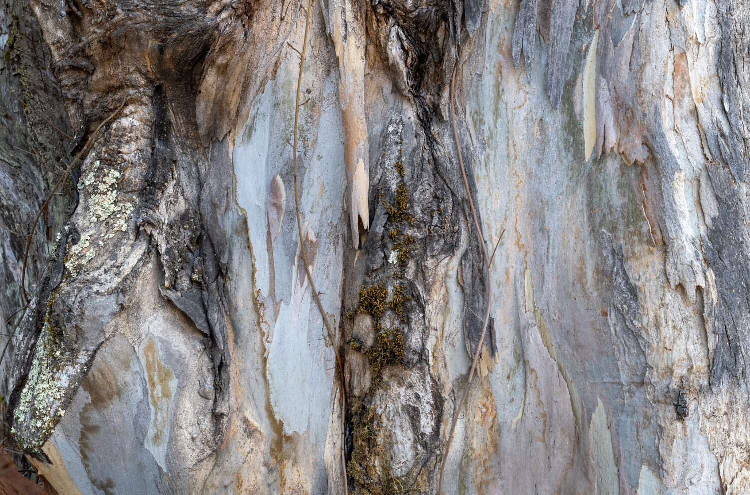
Constantly shedding bark is part of what makes eucalyptus trees a potential fire hazard. If shreds of loose bark catch fire, they can blow in the wind and carry flames to new areas. Photo: AlessandraRC
Louie points out that, in an era of unprecedented warming and drought, we can’t necessarily look to the past. “Things have changed drastically,“ she says. “We cannot just ignore that. It requires a whole shift of mindset to tackle this problem.”
First Street, which provides climate risk financial modeling, estimates that about 27,000 properties in San Francisco are at moderate risk of wildfire; they also estimate that, in 30 years, that number will have gone up by about 20%.
If your home is at risk from wildfire, what can you do about it? CALFire has guidelines on defensible space and fire-safe landscaping — but Louie thinks that implementing those guidelines in the city is unrealistic.
“The first five foot perimeter around a building should be free of combustible materials. So that includes patio furniture, most plants, and wooden fences,” says Louie. “They say that gravel and cement or concrete are the best options. But of course, looking around San Francisco, you know that’s not going to happen, right?”
Defensible space is a hard sell in the city, where row houses cozy up next to each other and gardens and trees grow tightly against buildings. “Even if I follow guidelines around my house, but my neighbor doesn’t, his house might catch on fire, which would set my house on fire,” says Louie.
To solve this problem, Louie believes we need to look to the trees. “It’s really important that the city starts to mitigate the risk among its unirrigated tree stands,” she says. “They’re just waiting to burn.”
Other Recent Posts
WRT
WRT is a landscape architecture and planning firm that does climate resilience and adaptation projects.
Gleaning in the Giving Season
The practice of collecting food left behind in fields after the harvest is good for the environment and gives more people access to produce.
New Study Teases Out Seawall Impacts
New models suggest that sea walls and levees provide protection against flooding and rising seas with little effect on surrounding areas.
Oakland High Schoolers Sample Local Kayaking
The Oakland Goes Outdoors program gives low-income students a chance to kayak, hike, and camp.
Growing Better Tomatoes with Less Water
UC Santa Cruz researchers find the highly-desired ‘Early Girl’ variety yields more tomatoes under dry-farmed conditions.
Santa Clara Helps Homeless Out of Harm’s Way
A year after adopting a controversial camping ban, Valley Water is trying to move unsheltered people out of the cold and rain.
The Race Against Runoff
San Francisco redesigns drains, parks, permeable pavements and buildings to keep stormwater out of the Bay and build flood resilience.


