


Relocating the Bay Trail at Alameda Point

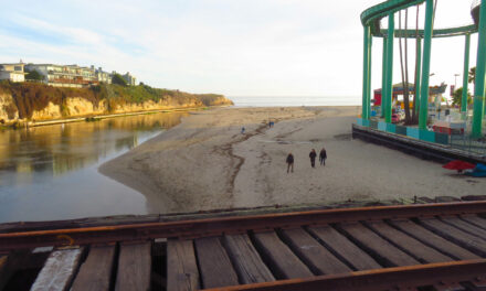
Three sites along the East Bay shoreline will demonstrate potential pathways for shoreline adaptation, as part of the San Francisco Bay Trail Risk Assessment and Adaptation Prioritization Plan led by the East Bay Regional Park District. One site called the Northwest Territory, planned as a new district park, will feature a Bay Trail extension around the full extent of Alameda Point. The site’s low-lying elevation presents both a flood risk to existing structures and an opportunity to restore valuable marsh habitat. Project consultants WRT, an urban planning and landscape architecture firm, stress the importance of collaboration in crafting successful shoreline adaptation projects.
WRT’s proposal for Alameda Point also hinges on the ability to remediate contamination left behind by the US Navy. Their “Full Potential” design, which assumes robust remediation of contaminated areas, would create more than 100 acres of tidal marsh and a western shoreline resistant to erosion from high wind and wave action. Their “Limited Potential” design, which works with the known design parameters set by soil contamination cleanup, offers comparatively modest wetland habitat and less space for habitat migration as the sea level rises. As such, the containment of contaminated soil and planned public access could be compromised by the end of the century. “The design options are presented here to keep open conversations with all of the stakeholders involved in the development of this significant regional park,” says WRT Principal John Gibbs.
First published in RARA Review, April 2021.
Other Recent Posts
Assistant Editor Job Announcement
Part time freelance job opening with Bay Area climate resilience magazine.
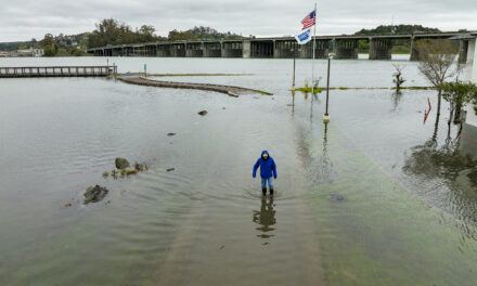
Training 18 New Community Leaders in a Resilience Hot Spot
A June 7 event minted 18 new community leaders now better-equipped to care for Suisun City and Fairfield through pollution, heat, smoke, and high water.
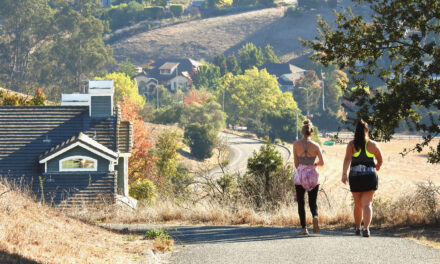
Mayor Pushes Suisun City To Do Better
Mayor Alma Hernandez has devoted herself to preparing her community for a warming world.
The Path to a Just Transition for Benicia’s Refinery Workers
As Valero prepares to shutter its Benicia oil refinery, 400 jobs hang in the balance. Can California ensure a just transition for fossil fuel workers?
Ecologist Finds Art in Restoring Levees
In Sacramento, an artist-ecologist brings California’s native species to life – through art, and through fish-friendly levee restoration.
New Metrics on Hybrid Gray-Green Levees
UC Santa Cruz research project investigates how horizontal “living levees” can cut flood risk.
Community Editor Job Announcement
Part time freelance job opening with Bay Area climate resilience magazine.
Being Bike-Friendly is Gateway to Climate Advocacy
Four Bay Area cyclists push for better city infrastructure.
