A May 2024 environmental conference covers levees, seawalls, reefs, wetlands, and other climate resilient shoreline designs for the Bay Area.

City & County Initiatives

Bay Area Regional Initiatives

Resilience Hub

Special Series: Extremes in 3D
A May 2024 environmental conference covers levees, seawalls, reefs, wetlands, and other climate resilient shoreline designs for the Bay Area.

Regional agencies made splashy headlines when they released a joint study on the likely cost of protecting Bay Area shores from rising seas: $110 billion. But the top-line number didn’t offer much insight into the complexities. A new inventory and map from the same agencies is much more revealing.
Coastal erosion in Pacifica, drought in Brentwood, fires in the North Bay, flooding in Union City, and urban heat in San Jose. Anissa Foster takes us on a revealing virtual tour.
All Stories

On Edgerly Island, homes sit behind a sinking, century-old levee. The community is at risk from sea level rise – unless they can agree to pay the cost of resilience.
A May 2024 environmental conference covers levees, seawalls, reefs, wetlands, and other climate resilient shoreline designs for the Bay Area.
Regional agencies made splashy headlines when they released a joint study on the likely cost of protecting Bay Area shores from rising seas: $110 billion. But the top-line number didn’t offer much insight into the complexities. A new inventory and map from the same agencies is much more revealing.

Coastal erosion in Pacifica, drought in Brentwood, fires in the North Bay, flooding in Union City, and urban heat in San Jose. Anissa Foster takes us on a revealing virtual tour.
Oona Khan dreams about her home of the future, after losing her Malibu retreat to fire. Caught in a quagmire of legal battles with Southern California Edison, and surging construction costs, Khan is still waiting to start construction.

What’s flat, covered in pavement, and unsafe for cyclists? Most Bay Area cities. But a Napa coalition recently published “Safe Routes to School” reports for 31 schools in the county. The routes also offer a healthier alternative to back seat commutes to class.
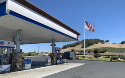
In April, a developer proposed a new gas station near a busy intersection in the City of Napa. But thanks to footwork of high schoolers, citizens and elected leaders Napa County and a growing number of North Bay cities have set zero-emissions goals for 2030, and declared a climate emergency. As a result, the new gas station was a no-go.

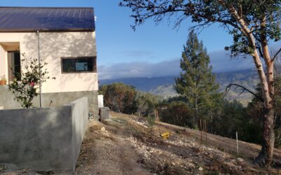
I’ve watched an army of white trucks topped with cranes and chippers remove the oaks, redwoods, bays and manzanitas from around the power lines on our mountain in Napa. PG&E is felling a million trees per year and spending over a billion to do it.
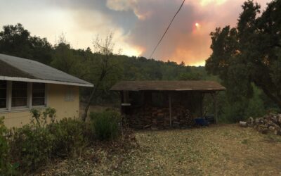
When Sonoma County residents smell smoke, they usually hop on social media or check some alert services like Nixle or PulsePoint to find out what’s going on. But social media isn’t really designed for quickly and accurately sharing disaster alerts.
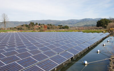
The stately Napa winery of Far Niente and the wastewater treatment plant for the small town of Healdsburg have more than picturesque vineyards in common. Each facility typically produces enough power on-site to run all their operations, and then some. Both hold national records. And the inviting irrigation pond tucked amidst the vineyards at Far Niente bears a striking resemblance to the ponds full of treated sewage-water in Healdsburg.

To help keep Highway 37 open despite heavy storms and rising tides, planners are assessing a wide range of options from elevating the road to rerouting it. But zeroing in on the right redesign may be trickier than anticipated. New research shows that, with sea level rise, protections for this troubled North Bay road can worsen flooding and economic damages as far away as the South Bay. The good news is that this work can also identify Highway 37 redesigns that avoid these catastrophic impacts.