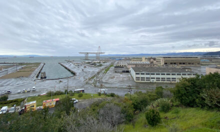
Just three weeks later, a massive $1 billion dollar housing and commercial development less than a mile upshore from the Chase Center received permission to break ground. Dubbed “Mission Rock,” the project is also designed for sea-level rise: 66 inches by 2100. In other words, almost twice as much as its waterfront neighbor.
Over the past decade a wave of these shoreline “mega-developments” have hit the Bay Area. Since 2010, developers have sunk $22 billion into more than a dozen waterfront projects less than eight feet above today’s high-tide line.
“In San Francisco, almost half of all new housing development in the city is concentrated along the waterfront,” says Emily Loper, policy director for the economic development advocacy group Bay Planning Coalition.
These projects promise thousands of much-needed housing units, millions of square feet of commercial space, and acres of waterfront public space. However, the State of California estimates sea-level rise of up to ten feet by 2100—a figure seemingly incongruous with the lower numbers used by developers, and one that would push many of these new mega-developments into risky flood zones.
For example, the Central Bay’s $6 billion Treasure Island development is designed to withstand three feet of sea-level rise. The $1 billion Alameda Point in the East Bay is built for 18 inches, with contingencies for higher levels. The overhaul of the Potrero Power Station in San Francisco’s Dogpatch neighborhood, which on April 21 became the first development virtually approved by the city due to coronavirus, is designed for 6.9 feet of sea-level rise. The Pier 70 project directly adjacent to Potrero will be about 1.5 feet lower than its neighbor, and its waterfront park will be even lower. These four projects alone total over $10 billion, and will provide 13,000 housing units (though only about 25% of them affordable) and hundreds of acres of parks, trails, and other public waterfront amenities. But how is it possible they use such different sea-level-rise numbers?
“No doubt an adaptive approach requires additional coordination over time, but I think it only makes sense that a project built today that will be around for 75 to 100 years or more will need to commit to planning and implementing measures to adapt its shoreline.”
“These developments have been in the works for many years, and the projections have changed over time,” explains Loper. In 2012, for example, the upper range of projected sea-level rise for California was 55 inches, or 4.6 feet by 2100. In 2018, the State of California issued revised estimates that now top out at 6.9 to 10 feet by the end of this century.
Dr. Kristina Hill, professor at UC Berkeley’s Department of Landscape Architecture and Environmental Planning, isn’t buying it. “There are documents from the 1990s pointing out the sea-level-rise problem,” she says. “Developers and the engineers they hired often chose a middle number, because it sounded reasonable. But they knew [it could be worse].”
Currently each project has the flexibility to choose from the State of California’s high, medium, or low sea-level-rise projections to determine its own risk based on unique site characteristics, lifespan, and consequence. “Not every project constructed today is completely resilient to the flood risk it might encounter in 2100,” points out Ethan Lavine, chief of permits at the San Francisco Bay Conservation and Development Commission (BCDC). “But each is being built in such a way they should be able to adapt to that flood risk when the time comes to do so.” BCDC has rigorously applied sea-level-rise policies requiring that projects be designed to withstand expected 2050 levels and have plans for adapting to 2100 levels.
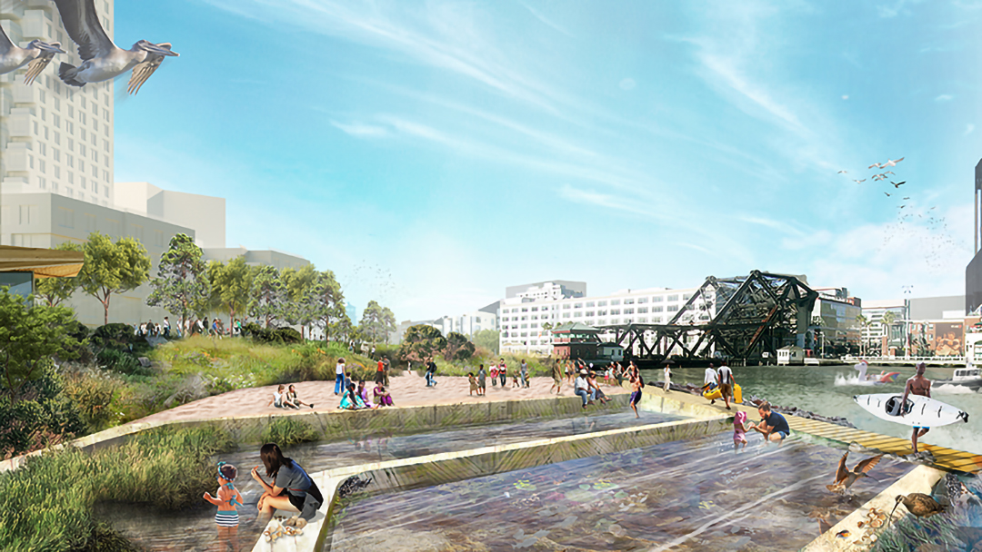
A few forward-thinking developers have planned for adaptation, acknowledging the need to be ready if the San Francisco Bay rises higher and faster than what they have designed for. Treasure Island, Pier 70, and Mission Rock are committed to monitoring local sea-level rise and developing future plans to improve drainage and shoreline protection as needed. Mission Rock even makes this a component of its shoreline park, with plans for terraced shelves to mark different tidal heights and the upwards creep of the Bay over time. All three projects will use fees generated via a special Community Facilities Districts to help pay for future adaptation measures.
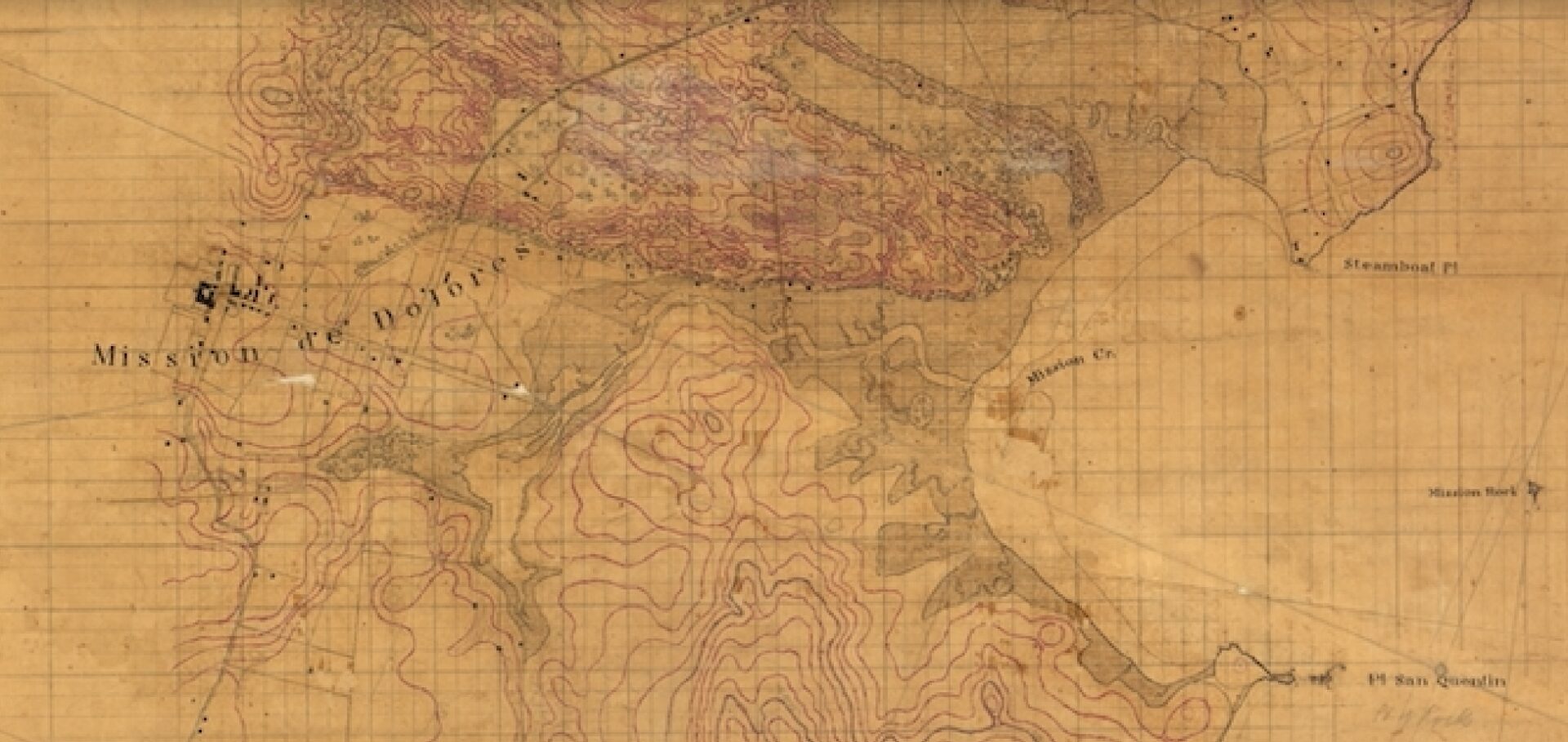
The Coast Survey’s 1852 (T352) map of Mission Bay’s 500 acres of wetlands and sloughs, 150 years before the area became San Francisco’s latest development hub. Map courtesy: John Cloud
However, even these adaptation attempts are fraught with uncertainties, such as how exactly to monitor and enforce a permit requirement 30 years into the future, or if the adaptation accounts will have sufficient funds when they are needed. And few appear to plan for the fact that due to stronger storms, extreme water levels will become more frequent. For example, a study this year found historical 50-year water heights could be an annual occurrence by 2050.
“No doubt an adaptive approach requires additional coordination over time,” admits Lavine. “But I think it only makes sense that a project built today that will be around for 75 to 100 years or more will need to commit to planning and implementing measures to adapt its shoreline.”
Other projects, however, have a more laissez-faire attitude towards sea-level rise. The Chase Center, with its sunken arena floor and basement practice courts below Bay level, relies on one of the lowest figures for future sea-level rise at three feet by 2100. Its “adaptation plan” to install floodgates and curbs appears to simply shunt floodwater away from the arena, where it could collect in adjacent streets and parcels. The $218 million luxury condo project at 75 Howard Street (also known as One Steuart Lane) and the $42.6 million Tidelands Condominiums in San Mateo appear to somehow have left out sea-level rise altogether in their design. Notably, all three of these projects were built outside of BCDC’s jurisdiction.
Why are these developments using lower sea-level-rise estimates, and therefore increasing their risk? One simple factor is the cost of importing dirt to raise grades, building floodwater retention projects, and lifting building pad heights. Additionally, factoring in higher sea-level rise could increase costs of toxic waste cleanup for legacy contaminants in projects like Bayview Hunters Point, Candlestick, and Treasure Island. Still, it’s not as if money is lacking: a real estate development industry standard is 20% return on investment, though individual projects can vary widely.
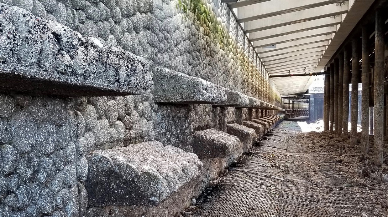
Fish friendly seawall in Seattle built in 2017. The design of the wall includes texture and complexity to encourage invertebrates to settle, an offshore habitat mattress of mesh-covered rocks to calm waves, and a glass sidewalk to allow more light to reach beneath the water’s surface (salmon do not like crossing shadow lines).
Photo courtesy City of Seattle.
Even so, many developments tend to fall back on unimaginative (and cheaper) adaptation strategies based on simply fortifying the shoreline. “We’re supposed to be a futuristic region, a tech region, and we’re doing seawalls?” asks Hill incredulously. “How lame, when we could be talking about floating cities and extensive beaches and wetlands.”
Another reason could be reliance on public infrastructure for protection. Hundreds of millions of taxpayer dollars are currently dedicated to raising miles of levees in Foster City and the South Bay, as well as buttressing and eventually replacing the San Francisco seawall (see page 7). In addition to shielding essential public facilities like ferry landings, fire and police stations, utilities, and waterfront streets, these massive public works will also end up protecting billions of dollars of private property. It is likely no coincidence that the Golden State Warriors were major funders of Proposition A, the San Francisco seawall bond, which passed in 2018. Or that Facebook, Inc. donated money toward the SAFER Bay project that will end up shielding its Menlo Park waterfront campus from rising waters.
“I’m sure private projects that haven’t adequately prepared for sea-level rise are counting on public funds to provide protection in the future,” Hill says.
“We absolutely need to plan for how these major shoreline protection projects can be accomplished with equity as a primary, co-equal goal [to protection],” adds Lavine diplomatically.
Another issue is that these developers will be long gone in 20 or 30 years, when the one-to-two feet of sea-level rise that they have designed for is lapping at our doorsteps. Which raises the question, who will be left to pick up the bill if and when these developments flood? As the San Francisco Bay gradually creeps higher, it is not clear who will be liable for developments that suddenly find themselves in the flood hazard zone, nor what the requirements are for flood insurance and disclosures pertaining to future flood hazards. Not to mention the legal mess that would result if flooding goes through an underbuilt property to its neighbor, or adjacent public streets.
“A lot of this is going to come out in the courts,” says Hill. “And we’re still waiting to see how the public trust doctrine will be interpreted as the tide gets higher. That’s why it’s so important that the region starts planning ahead and blocking developments that will be fragile and expensive.”
As if there weren’t enough barriers to sea-level-rise adaptation, the economic downturn caused by the coronavirus pandemic will inevitably tighten adaptation and resilience budgets. Loper points out optimistically that this makes the private developer adaptation commitments even more essential, but concedes a regional shoreline protection plan is critical.
“There has to be a larger strategy in place so that these projects are not simply islands of resilience,” agrees Lavine.
Hill, however, is more blunt. “We have a choice between leaving future generations vulnerable properties and rigid seawalls, or resilient properties and dynamic wetlands,” she says. “Do we want to leave behind a legacy, or liability?”
Note: Isaac Pearlman formerly worked at BCDC as an environmental scientist.
First published by Estuary News Group, June 2020, but foundational in its scope.


